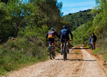
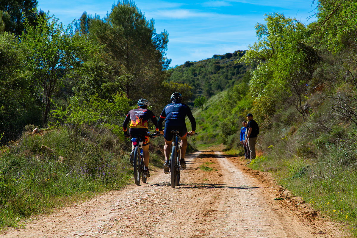
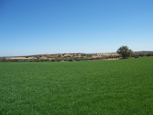
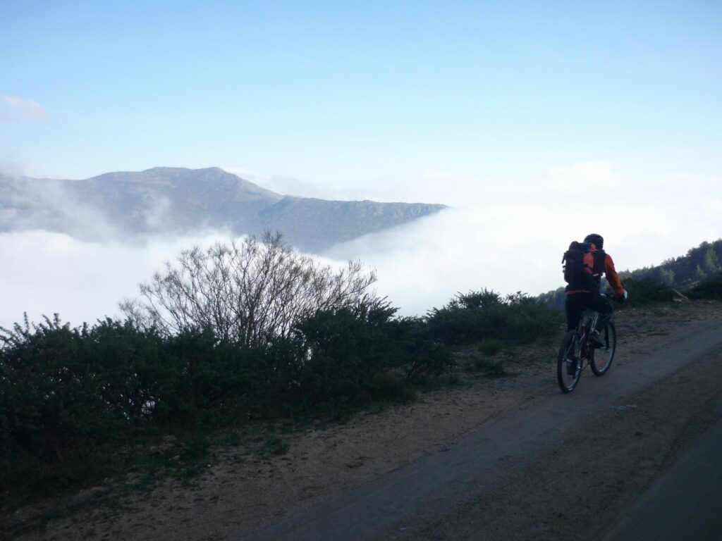
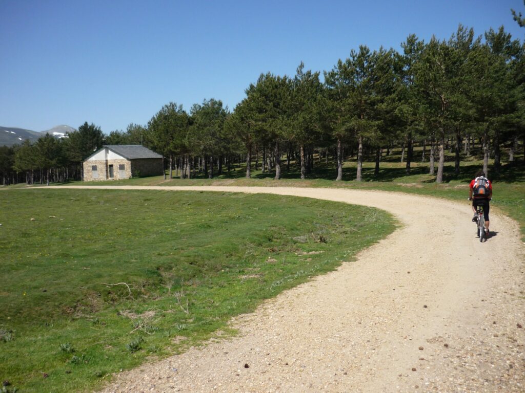
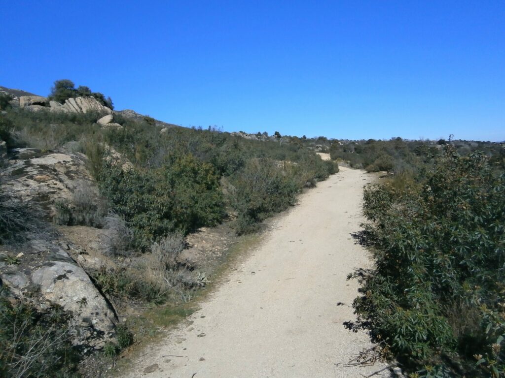
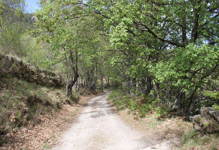
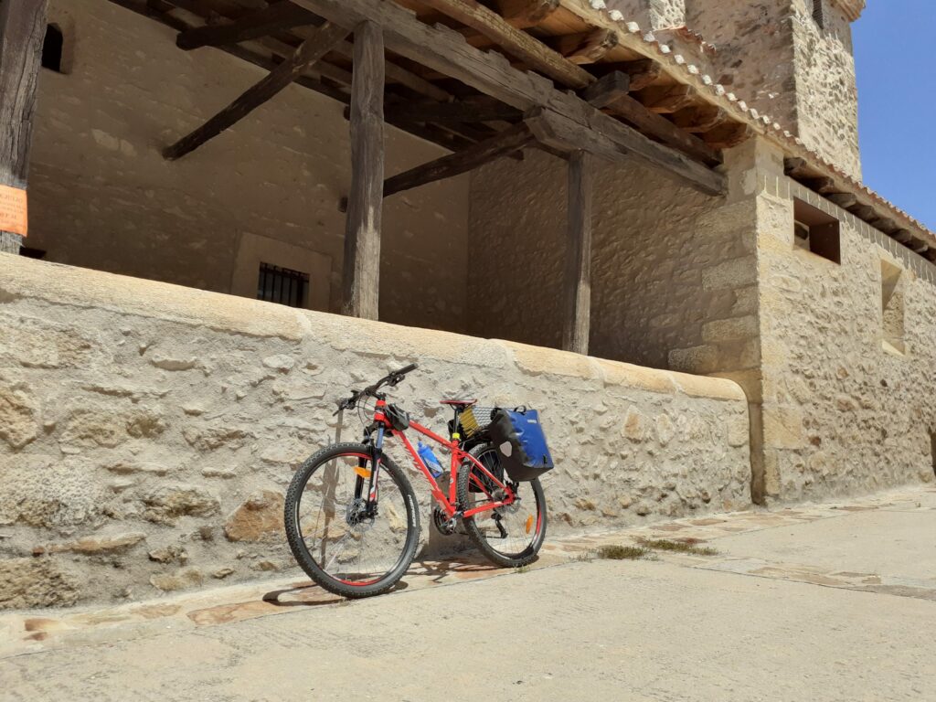
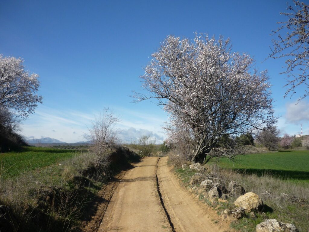
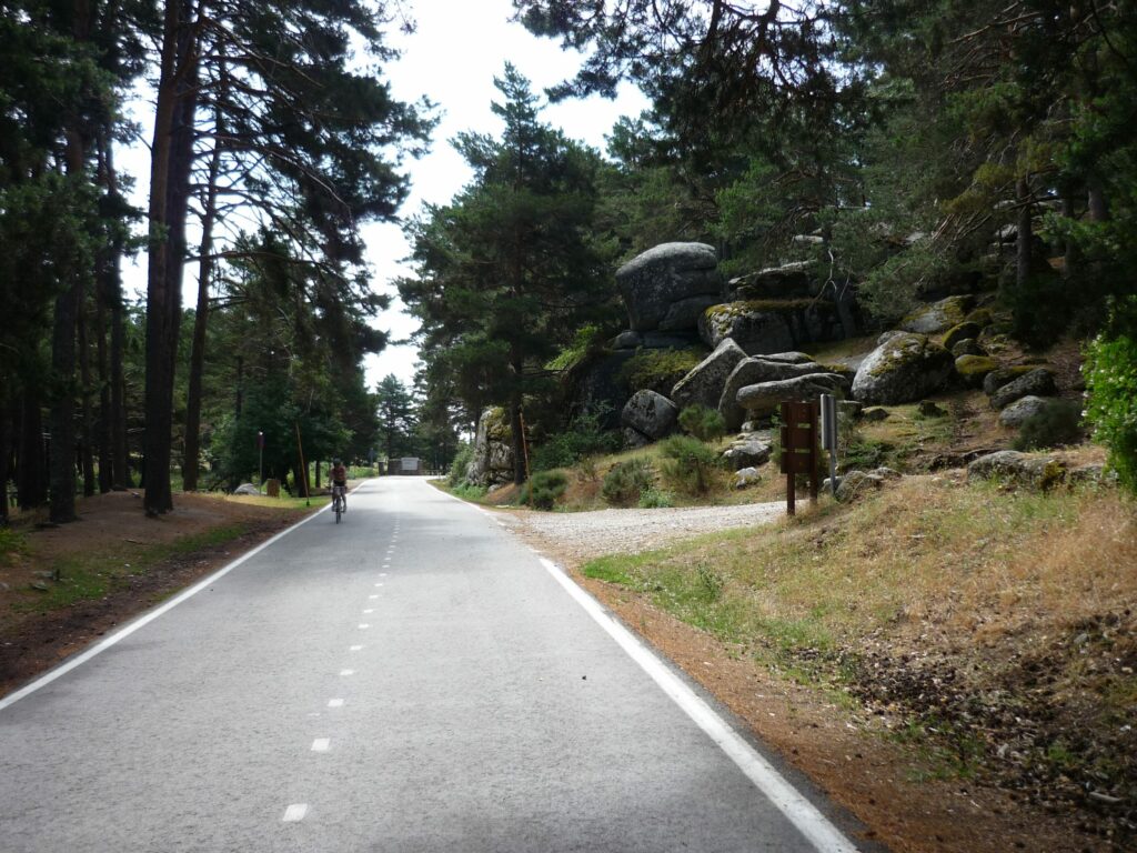
The four territories of MadRural are ready for you to explore them with your MTB or road bike, on day trips or by doing a tour. There are routes for all tastes and levels. Each and every one of these proposals covers the rich diversity of landscapes offered by the territories of this destination. You will find mountain peaks, holm oak pastures, and olive and vineyard fields. A natural paradise within your reach in the Sierra Norte, Sierra de Guadarrama, Sierra Oeste, and the Vegas & Alcarria Madrileña.
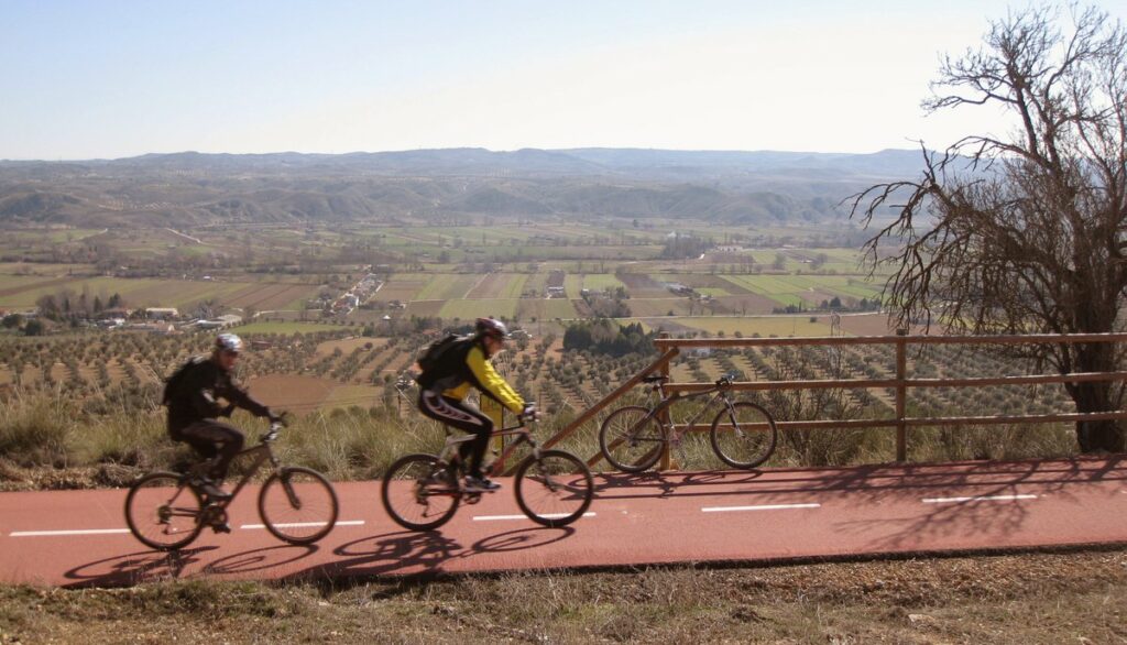
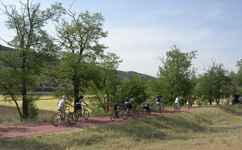
We suggest you take your bike to follow in the footsteps of ancient transhumants and ride along the drovers’ roads that cross the Community of Madrid. Places like the Cañada Real Soriana Oriental, Cañada Real Leonesa, Cañada Real Segoviana, Cañada Real de Merinas, and even a section of the Camino de Santiago. Other perfect spots for bike lovers are the Vía Verde del Alberche, Vía Verde del Tajuña, and the Vía del Tren de los 40 días. All of them are also ideal for family rides. Additionally, you can enjoy a total of 8 bidirectional cycling loops with over 300km of cycleable paths in the Sierra de Guadarrama.
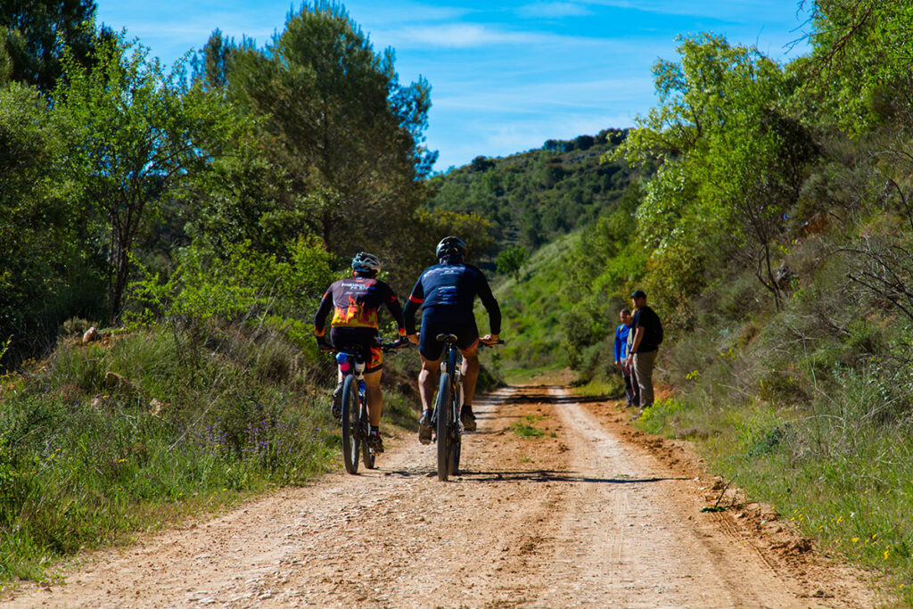
An interesting tour for MTB/BTT bikes is the TransCAM, which covers the entire Community of Madrid, or the CiclaMadrid MTB Tour route, which allows you to travel through the Sierra Norte de Madrid and the Sierra de Guadarrama.
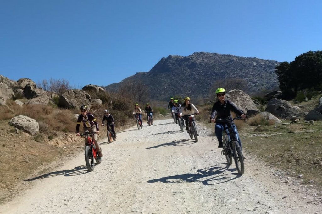
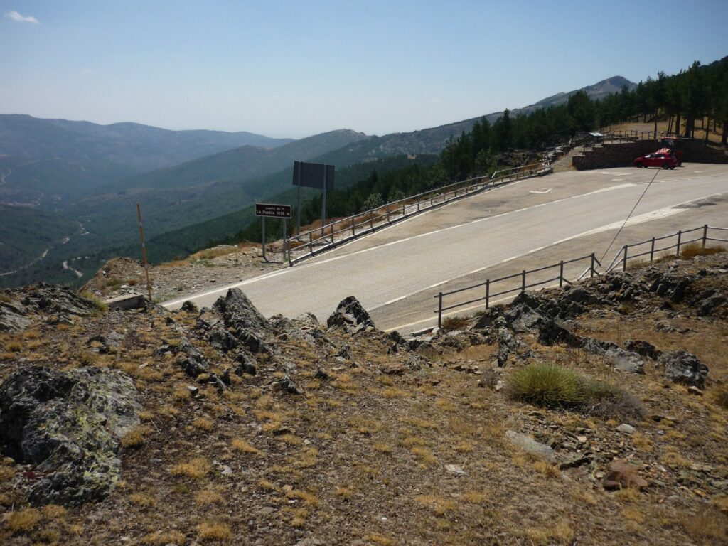
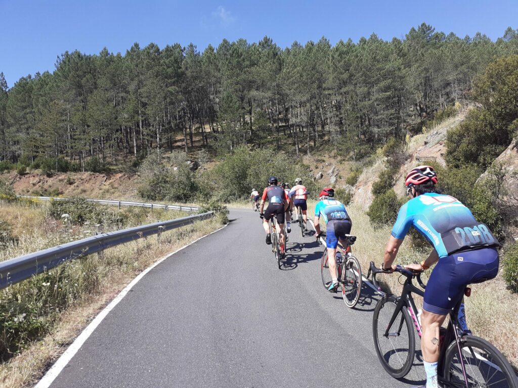
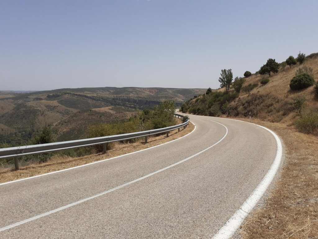
If you prefer road cycling, we invite you to discover the sections of the CiclaMadrid Tour, which pass through the Sierra Oeste, Sierra Norte, the Vegas, and Alcarria Madrileña, following idyllic country roads. In the Sierra de Guadarrama, you also have the «mountain pass area,» home to some of the highest mountain passes in the Community of Madrid, including Puerto de Navacerrada (the highest), Puerto de la Morcuera, and Puerto de los Leones for those who want to gain elevation and test their legs. And, in this territory, we also invite you to discover one that will surprise you.
RECOMMENDED SEASON
All year round.
TARGET AUDIENCE
MTB and road cycling enthusiasts and professionals.
DURATION
One day, a weekend, or a week-long tour.

On two wheels

Vegas & Alcarria Madrileña
Olmeda de las Fuentes, Valdilecha, Perales de Tajuña, Tielmes, Carabaña, Orusco de Tajuña, Ambite, Carabaña, Valdaracete, Estremera, Villar del Olmo, Brea de Tajo, Fuentidueña de Tajo.
Olmeda de las Fuentes
Route through the Madrid Alcarria. MTB
Route start
Length: 72 km.
Difficulty: High. Circular. Unmarked.
This route covers a large part of the Alcarria de Alcalá, passing through the towns of Olmeda de las Fuentes, Nuevo Baztán, Pozuelo del Rey, Campo Real, Loeches, Torres de la Alameda, Valverde de Alcalá, Villalbilla, Anchuelo, Los Santos de la Humosa, Santorcaz, and Pezuela de las Torres. Ideal to do in spring, when the cereal fields turn from green to gold and are covered with poppies.
Valdilecha
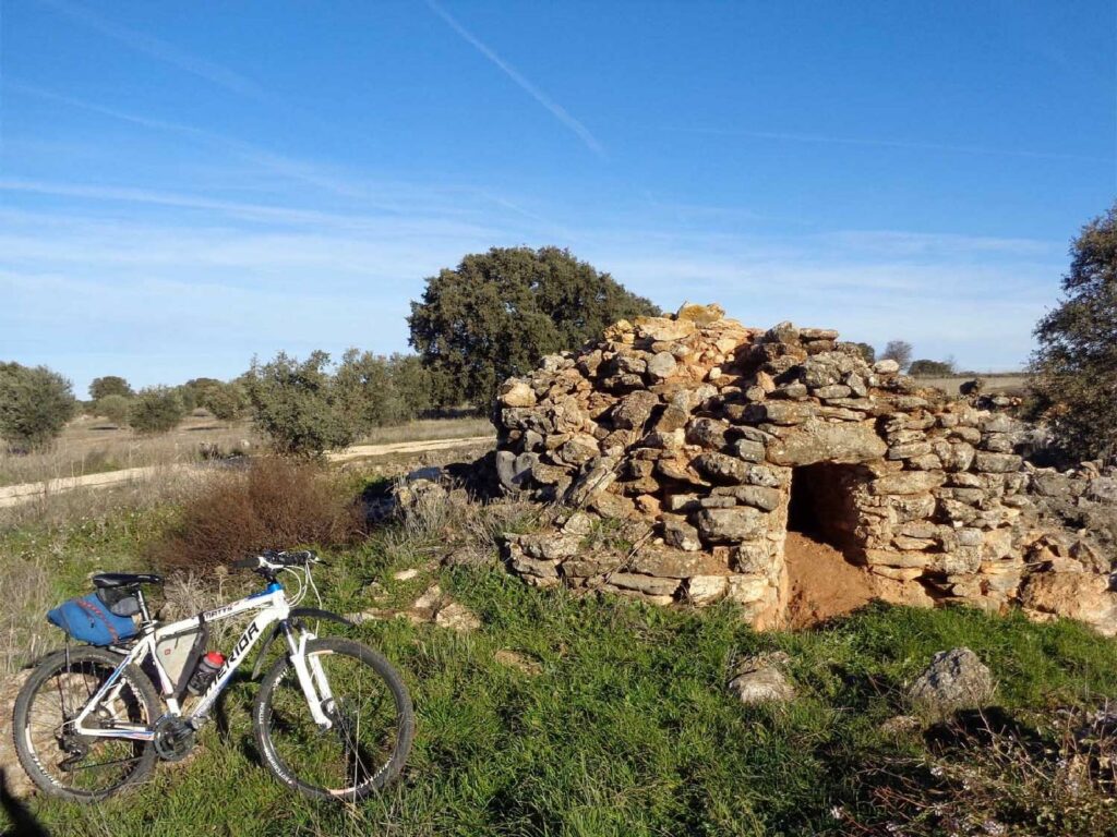
Route through the Stone Huts. MTB
Route start
Length: 38 km.
Difficulty: Low. Circular. Marked
Tourist and cultural walk through the fields of southeastern Madrid and the Madrid Alcarria. Starting from Valdilecha, a circular route is taken to visit up to 17 huts, buildings generally made of limestone and minimal mortar, which served as shelters for shepherds on their transhumant journeys.
Vía Verde del Tajuña
Morata de Tajuña – Perales de Tajuña – Tielmes – Carabaña – Orusco de Tajuña – Ambite. MTB
Total length: 49 km.
Difficulty: Medium-low. Linear. Red asphalt. Signposted. Rest areas.
This Greenway, which runs alongside the river of the same name in the Community of Madrid through a pleasant landscape of meadows, is very easy to follow as it has a red asphalt surface throughout. The route starts in Arganda del Rey and runs for 49 km to Ambite. It is perfect for enjoying by bicycle, on foot, or even on skates. Furthermore, many of its sections are fully accessible.
Brea de Tajo
Route through the countryside of the Cañada Real Soriana Oriental. MTB
Route start
Route end
This route takes place entirely within the municipality of Brea de Tajo, which will be its starting and ending point. Throughout the route, we will enjoy the agricultural landscape that marks the main activity of this municipality, a mosaic of olive groves and vineyards against a backdrop of land with a vocation for cereal cultivation. It is ideal for spring.
More information:
www.comunicad.madrid
vegasyalcarriamadrid.com
Via del Tren de los 40 Días
Section 1: Carabaña – Valdaracete – Estremera. MTB
Length: 15 km.
Difficulty: Medium-low. Red asphalt surface. Signposted.
This route passes through several trenches (cuts) and bullfighting ranches. It allows you to easily and pleasantly explore the landscapes of the Cañada Real Soriana Oriental and, at the same time, learn about testimonies of the Spanish Civil War.
More information:
www.xn--ayuntamientocarabaa-d4b.es
www.viasverdes.com
Section 2: Villar del Olmo. MTB
Length: 12 km.
Difficulty: Medium-high. Circular. Signposted.
Along the route, three trenches are preserved. These are large embankments converted into tunnels. The station did not fare as well, as not even the platform on which it was built has been preserved. It is worth noting that along the way, we will find panels with QR codes that will provide additional information about the route and its surroundings.
More information:
www.villardelolmo.es
www.viasverdes.com
Valdaracete
Route of the Olive Groves. MTB
Length: 13.5 km. By bike, 50 minutes. On foot, 2 hours.
Difficulty: Low. Circular. Signposted in blue. Dirt road / road.
Route start
Along the route, we will enjoy an agricultural landscape and, along the Cañada, low scrubland formed by kermes oak. On this route, we will find the Descansadero de Corrales de Trazas, a resting place for merino sheep and shepherds on their transhumance journeys.
More information:
www.comunidad.madrid
vegasyalcarriamadrid.com
Fuentidueña de Tajo
Cañada Real Soriana Oriental. MTB
Length: 30 km.
Difficulty: Medium. Linear. Signposted.
Route start
The route begins in Fuentidueña at the iron bridge over the Tajo River. It runs through the agricultural landscapes characteristic of this area of the Community of Madrid. It winds through hills until it reaches the plains of the páramo, passing through areas that alternate between dry farming land and native vegetation. Along the way, we will find curious constructions related to transhumance, such as huts and corrals, which were used as shelters by transhumant shepherds.
More information:
vegasyalcarriamadrid.com

TransCAM Routes. MTB
Corpa, Olmeda de las Fuentes, Ambite, Orusco de Tajuña, Carabaña, Estremera, Fuentidueña de Tajo, Villamanrique de Tajo, Colmenar de Oreja.
The TransCAM sections that cross the Alcarria de Alcalá and the Las Vegas & Alcarria Madrileña region are:
Section 4: Alcalá de Henares – Estremera
Length: 68 km.
Difficulty: 4/5
This stage starts in Alcalá de Henares and runs along the southeastern border of the Community of Madrid, crosses the spectacular Parque de los Cerros, and passes through the towns of Villalbilla, Corpa, Olmeda de las Fuentes, Ambite, Orusco de Tajuña, and Carabaña, ending in Estremera.
More information: https://transcam.org/tramo-4-alcala-de-henares-estremera/
Section 5: Estremera – Aranjuez
Length: 61 km.
Difficulty: 3/5
This stage begins in Estremera, the easternmost municipality of the Community of Madrid, and coincides in part with the Camino de Uclés. It starts heading south but soon turns west, running parallel to the Tajo River and the southern border of the Community, coinciding partly with the Tajo Natural Path and then with the Canal de Estremera Natural Path. It passes through Fuentidueña de Tajo, Villamanrique de Tajo, Colmenar de Oreja, and the Cortijo de San Isidro, ending in Aranjuez, a World Heritage city.
More information: https://transcam.org/tramo-5-estremera-aranjuez/
CiclaMadrid
Aranjuez – Villaconejos – Chinchón – Colmenar de Oreja – Villarejo de Salvanés – Carabaña – Orusco de Tajuña – Ambite – Nuevo Baztán Section
The Gran Tour CiclaMadrid is a 420 km grand tour to be completed in stages. Two sections of CiclaMadrid pass through the Comarca de las Vegas and the Alcarria de Alcalá, full of culture, gastronomy, and heritage. These are three perfect routes for nature lovers and those who enjoy rural areas with charming towns. The first section allows you to discover the heritage richness of Aranjuez and Chinchón, crossing the fertile garden lands that run between the two towns. The second stage is ideal for enjoying Madrid wines by bike. The third itinerary runs through riverside and Alcarrian landscapes, across a variety of ecosystems and a natural environment of high ecological value on the banks of the Tajuña River.
More information: http://www.ciclamadrid.es/ciclamadrid/
Sierra Oeste
Fresnedilla de la Oliva, Villamanta, Villanueva de Perales, Pelayos de la Presa, Villa del Prado, San Martín de Valdeiglesias, Zarzalejo, Robledo de Chavela, and Aldea del Fresno.
Fresnedillas de la Oliva
Route of the Cordel del Puente de San Juan. MTB
Start of the route
Length: 12 km.
Difficulty: Medium. Circular. Signposted (blue markers and arrows).
This path runs mostly along the Cordel del Puente de San Juan, a branch of the Cañada Real Leonesa Oriental as it passes through the municipality of Fresnedillas de la Oliva. The route runs through a mixed landscape of dehesa and crosses several seasonal streams and wetlands such as La Yunta, El Teniente, or La Moraleja.
More information:
turismosierraoeste.es
Villamanta, Aldea del Fresno, Chapinería, and Villamantilla
Route through Aldea del Fresno and the Perales River. MTB
Length: 39 km.
Difficulty: Medium. Circular. Unsignposted.
Route start
This beautiful route allows you to explore the heart of the ZEPA 56 area, passing through Aldea del Fresno, Chapinería, and Villamantilla, following the old transhumance paths of the Cañadas Real Segoviana and Real de Merina.
More information:
www.turismosierraoestemadrid.org
es.wikiloc.com/rutas-mountain-bike
Villanueva de Perales
Route of the Cañada Real Segoviana. MTB
Length: 21 km.
Difficulty: Low. Circular. Signposted (magenta markers and arrows).
Route start
This route starts from Villanueva de Perales along the Cañada Real Segoviana to the north and reaches the Casas de la Encrucijada, on the M-501 road. Its second section goes from Casas de la Encrucijada to Sevilla la Nueva. Following the road to Perales, you cross magnificent dehesas with beautiful views of the Sierra de Guadarrama. The last section of 9 kilometers, which runs along rural roads and a stretch of the Cañada Real Segoviana, leads from Sevilla la Nueva to Villanueva de Perales through very picturesque landscapes.
More information:
turismosierraoestemadrid.org
Pelayos de la Presa
Via Verde del Alberche. MTB
Length: 14 km. from Pelayos de la Presa. 35 km. from San Martín de Valdeiglesias.
Difficulty: Low. Linear.
Route start (from Pelayos de la Presa)
Route start (from San Martín de Valdeiglesias)
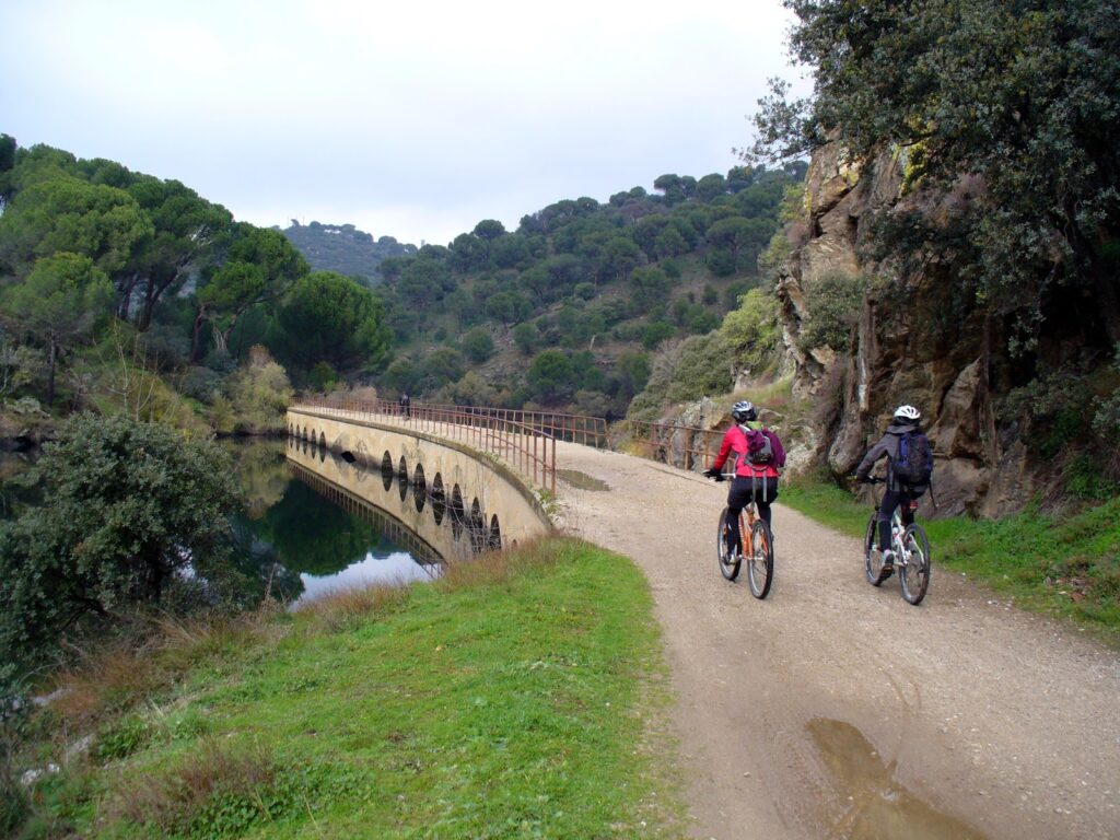
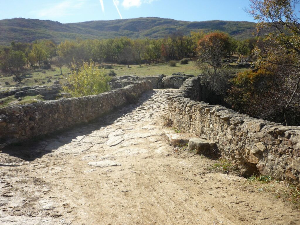
This is one of the simplest and most scenically beautiful routes in the Community of Madrid. The Via Verde del Alberche follows the route of an old railway that never operated. In the most spectacular section, the route runs parallel to the Picadas reservoir, flanked by pine and poplar trees that are reflected in its waters. We can cross elements of railway and structural architecture, such as tunnels carved into the rock, and also cross bridges on both banks of the reservoir.
More information:
www.viasverdes.com
Ruta del Boquerón. MTB
Route start
The route starts from Pelayos de la Presa towards San Martín de Valdeiglesias. It is a very varied route where you can enjoy both lush vegetation and panoramic views. The slopes are not very difficult as they are not excessive. The biggest challenge may be the climb to the Fuenfría hills, but the rest of the way will not present major problems.
More information:
sendasdemadrid.es
TransCAM Routes. MTB
Villa del Prado, San Martín de Valdeiglesias, El Escorial.
The TransCAM sections that cross the Sierra Oeste are:
Stage 7: Griñón – Villa del Prado
Length: 64 km.
Difficulty: 2/5
This section of TransCAM runs along the southern edge of the Community. It enters the Sierra Oeste through the municipality of Aldea del Fresno, known for its Arab-origin water wheel, but above all, for the river beaches of the Alberche River. The stage ends in the beautiful municipality of Villa del Prado, the orchard of Madrid.
More information: transcam.org/tramo-7-grinon-villa-del-prado
Stage 8: Villa del Prado – San Martín de Valdeiglesias
Length: 57 km.
Difficulty: 4/5
This semi-circular stage connects the municipalities of Villa del Prado and San Martín de Valdeiglesias. It passes through the municipality of Cadalso de los Vidrios, an enclave rich in history and the birthplace of good wines, and then reaches the westernmost municipality of the Community of Madrid: Cenicientos. At the foot of the Peña de Cenicientos lies this town, a discreet witness to the passage of Visigoths and Romans, where the taste for quality wine and oil comes from tradition. The stage ends in San Martín de Valdeiglesias, well known for its beaches on the San Juan reservoir. From this beautiful municipality, you can also connect with the TransIberia route or the GR 10 Long-Distance Path.
More information: transcam.org/tramo-8-villa-del-prado-san-martin-de-valdeiglesias
Stage 9: San Martín de Valdeiglesias – Pelayos de la Presa – Robledo de Chavela – Zarzalejo – El Escorial
Length: 45 km.
Difficulty: 3/5
This section of TransCAM begins in San Martín de Valdeiglesias and heads to Pelayos de la Presa, where the oldest monastery in the Community of Madrid, Santa María la Real de Valdeiglesias, can be seen. From there, you can also access the San Juan reservoir. You should continue to Robledo de Chavela, home to the NASA space station and areas of great natural beauty. From here, the route goes to Zarzalejo, a beautiful town nestled at the foot of the Machotas mountains, considered the true viewpoint of the Sierra Oeste and where the Romans built one of their roads. From Zarzalejo, it is also possible to connect with the RC5 (a radial route connecting TransCAM with the green ring) or finish stage 9 in San Lorenzo de El Escorial.
More information: transcam.org/tramo-9-san-martin-de-valdeiglesias-san-lorenzo-de-el-escorial
CiclaMadrid
The Gran Tour CiclaMadrid is a 420-kilometer grand tour to be completed in stages. All of Madrid in just 17 steps. The Tour is tailored for anyone. The stages are about 25 kilometers long. You can adapt it to your own characteristics, as you only need to link stages where you want, or do them one by one. Mornings are for cycling, afternoons for walking… That’s the idea. We have selected the CiclaMadrid stages that run through the Sierra Oeste for you.
Stage: San Lorenzo de El Escorial – Zarzalejo – Robledo de Chavela
Through the communal dehesa, in the shade of Mount Abantos and Las Machotas.
17 km. / + 280 m. / 1:45 h.
Stage: Robledo de Chavela – Pelayos de la Presa – San Martín de Valdeiglesias
Waters of San Juan among pine forests, through the foothills of Gredos.
31 km. / + 424 m. / 3:15 h.
Stage: San Martín de Valdeiglesias – Pelayos de la Presa – Aldea del Fresno
Territory of the Iberian Imperial Eagle, garnacha and malvar oak forests.
25 km. / 273 m. / 2:30 h.
Stage: Aldea del Fresno – Villamanta – Navalcarnero
From the dehesas to the plains, land of garnacha and malvar wines.
22 km. / + 321 m. / 2:15 h.
More information: www.ciclamadrid.es
Sierra Norte
Lozoyuela, El Berrueco, Patones, Robledillo de la Jara, Manjirón, Horcajo de la Sierra, Lozoya, Rascafría, Puebla de la Sierra, Bustarviejo, Prádena del Rincón, Torrelaguna, Buitrago del Lozoya.
Lozoyuela
Ruta al Espaldar. MTB
Distance: 20.7 km.
Difficulty: Moderate.
Beautiful itinerary with the constant panoramic view of the sharp Sierra de la Cabrera through paths and trails among meadows, ash groves, pine forests, junipers, rockroses, and dotted with whimsical rock formations in the granite.
More information: www.sierranortemadrid.org
El Berrueco, Patones, Robledillo de la Jara, Manjirón
Senda del Genaro – GR300. MTB
Distance: 71.4 km.
Difficulty: Difficult
As it is a Great Route, the start can be made from any of the towns through which the path passes. Ideal for getting to know the environment surrounding the El Atazar reservoir, the hydraulic structures associated with water supply, the historically rich drove roads, and the rugged landscapes full of chromatic contrasts.
More information: www.sierranortemadrid.org
Horcajuelo de la Sierra
The Sources of the Jarama. MTB
Distance: 32.7 km.
Difficulty: Medium
Route through one of the most hidden valleys in the Sierra Norte, specifically the headwaters and upper valley of the Jarama. A very complete route, where you can enjoy landscapes, forests, mountain passes, and towns that combine along the route.
More information:
www.sierranortemadrid.org
Lozoya
The Highlands of El Hontanar
Distance: 42.8 km.
Difficulty: Medium
Spectacular route that combines a mosaic of different landscapes and allows us to enter the Sierra de Guadarrama National Park.
More information:
www.sierranortemadrid.org
Rascafría
The Highlands of La Morcuera. MTB
Distance: 31.7 km.
Difficulty: Medium
Itinerary that allows you to ascend the Aguilón stream along the slopes of La Cuerda Larga, one of the most characteristic mountain ranges of the Sierra de Guadarrama National Park. Beautiful descent from the highlands to the upper Lozoya valley.
More information:
www.sierranortemadrid.org
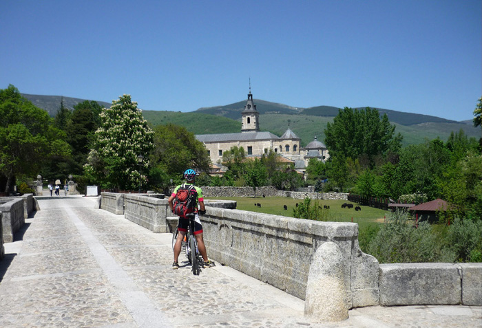
Camino Natural del Valle del Lozoya. MTB
Distance: 39 km.
Difficulty: 3/5
Route fully equipped for hiking and cycling. It runs through the entire upper Lozoya valley, allowing a tour of the towns in the valley, and also passes through interesting heritage sites such as the El Paular monastery or the walls of Buitrago. Ideal for cycle touring over two or three days.
More information: www.sierranortemadrid.org
If you want to do the route in an organized group, more information at: www.sierranortemadrid.org
Puebla de la Sierra
Vuelta al Porrejón. MTB
Distance: 16.8 km.
Difficulty: Medium
Route through the heights of the Sierra Norte, with beautiful panoramic views of the Sierras del Rincón and Ayllón. Complete circular route around the Porrejón peak, does not require excessive time to complete. Ideal for a morning or afternoon.
More information:
www.sierranortemadrid.org
Bustarviejo
Vuelta a El Pendón. MTB
Distance: 19.6 km.
Difficulty: Moderate
Route that circles the El Pendón hill, crossing a variety of landscapes and with magnificent views of the foothills. Medium difficulty due to the distance covered, ideal path for mountain biking.
More information:
www.sierranortemadrid.org
Bustarviejo Valle Hermoso. MTB
Distance: 14.3 km.
Difficulty: Easy
Comfortable ride to do with our mountain bike, ideal for a morning or afternoon. Beautiful route through the Vallehermoso dehesa.
More information:
www.sierranortemadrid.org
Buitrago del Lozoya
On the Front Line. Civil War in the Sierra Norte. MTB
Distance: 41 km.
Positive elevation gain: 820 m.
This route allows you to discover the valuable military infrastructure preserved in the Sierra Norte through the thread of the Civil War. The cycle touring route follows the mountain roads and paths while we traverse the water front and the Somosierra front.
More information:
www.sierranortemadrid.org
Torremocha de Jarama
Camino Mendocino. MTB
Distance: 30.5 km.
Difficulty: 3/5
This path is part of the Camino de Santiago, making it an original way to experience it from the central part of the country. In this case, we show you the section that runs from Uceda to Guadalix.
More information:
www.sierranortemadrid.org
Lozoya
From Dam to Dam. The Water Sierra. MTB
Distance: 56.1 km.
Difficulty: Easy
This interesting route allows you to visit three of the five dams that hold the waters of the Lozoya River. A beautiful route to cycle during the thaw or after prolonged rain when the dams open their floodgates to delight in the power of the water.
More information:
www.sierranortemadrid.org
CiclaMad MTB Tour
Distance: 213 km.
Difficulty: Medium-high
A 213 km circular route that covers the Sierra Norte of Madrid, specially designed for MTB. It runs through areas of high environmental and landscape value such as the Sierra de Guadarrama National Park, two Biosphere Reserves, and Natura 2000 sites, and also passes through numerous towns. Almost the entire route runs along forest tracks and paths with a comfortable width and in very good condition. The itinerary is generally of medium difficulty, considering that it crosses a mountainous territory.
More information:
www.sierranortemadrid.org
If you want to do the route in an organized group, more information at:
CycleMadrid
Prádena del Rincón
Circular Sierra de la Puebla
Distance: 50.9 km.
Positive elevation gain: 1272 m.
Beautiful itinerary with the Sierra de la Puebla as the protagonist. It travels along very quiet roads with surprising landscapes.
More information:
www.sierranortemadrid.org
Ports of La Morcuera and Canencia
Distance: 61.3 km.
Positive elevation gain: 1236 m.
This route allows access through a circular route to two of the most renowned mountain passes in the entire Community of Madrid. The route also offers impressive natural landscapes and allows you to enter the Sierra de Guadarrama National Park.
More information:
www.sierranortemadrid.org
Torrelaguna
The Valgallegos Trap and El Atazar Surroundings
Distance: 59.3 km.
Positive elevation gain: 1237 m.
Spectacular road cycling route for enthusiasts looking for demanding ramps and mountain passes, offering spectacular and varied landscapes through the Valgallegos dehesa, the El Atazar reservoir, and the Jarama Valley. It also offers the possibility of climbing to the town of El Atazar.
More information:
www.sierranortemadrid.org
TransCam Routes. MTB
El Atazar, Montejo de la Sierra, Puebla de la Sierra, Patones, Torrelaguna, Lozoya, Rascafría, Oteruelo del Valle, Alameda del Valle, Pinilla del Valle.
The TransCam sections that cross the Sierra Norte of Madrid are:
Section 1: Somosierra – El Atazar
Length: 56 km.
Difficulty: 4/5
Stage that begins north of the Autonomous Community of Madrid, in Somosierra, and continues clockwise to descend to Horcajuelo de la Sierra. It continues east to Montejo de la Sierra and towards Puebla de la Sierra. Finally, it descends to end in El Atazar.
More information: transcam.org/tramo-1
Section 2: El Atazar – El Molar
Length: 43 km.
Difficulty: 2/5
We start the stage in El Atazar, descending to the reservoir, to continue along the service road of the Jarama Canal passing by Patones to reach Torrelaguna and then continue south to end in El Molar.
More information: transcam.org/tramo-2
Section 11: Manzanares El Real – Lozoya
Length: 52 km.
Difficulty: 3/5
Stage that begins in Manzanares El Real and heads northeast to head north, ascending to reach the Puerto de La Morcuera. From here, it descends to the Monastery of El Paular, then heads to Rascafría, Oteruelo del Valle, Alameda del Valle, Pinilla del Valle, ending in Lozoya, next to the Pinilla reservoir.
More information: transcam.org/tramo-11-manzanares-el-real-lozoya
Section 12: Lozoya – Somosierra
Length: 59 km.
Difficulty: 4/5
Stage that begins in Lozoya and ascends for 11 km to reach the Puerto de Navafría, then begins to level off and descend for the rest of the stage, cycling along the famous horizontal track until reaching Somosierra.
More information: transcam.org/tramo-12-lozoya-somosierra
CiclaMadrid
The Gran Tour CiclaMadrid is a great 420-kilometer route to be completed in stages. All of Madrid in just 17 steps. The Tour is tailored for anyone. The stages are about 25 kilometers long. It can be adapted to individual characteristics as you only need to link stages where you want, or do them all one by one. Mornings are for cycling, afternoons for strolling… That’s the idea. We have selected the CiclaMadrid stages that run through the Sierra Norte.
Stage: Algete – Torrelaguna
The upper Jarama basin, from the plateau to the mountains
32.11 km. / + 295 m. / 3h:15 min.
Stage: Torrelaguna – Venturada – Miraflores
Through the south of the Sierra Norte, on the way to Miraflores.
28.56 km. / + 636 m. / 2h:50 min.
Stage: Miraflores to Manzanares El Real
Route of the Mendoza Castle
19.12 km. / + 190 m. / 2h:00 min.
More information: CycleMadrid
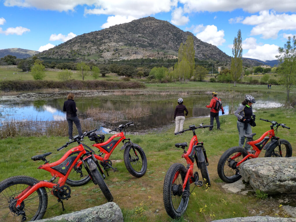
Sierra de Guadarrama
Guadarrama, Miraflores de la Sierra, Alpedrete, Becerril de la Sierra, El Boalo-Cerceda-Mataelpino, Collado Mediano, Moralzarzal, Soto del Real, Hoyo de Manzanares.
The Sierra de Guadarrama Destination has developed a project for mountain biking (MTB), which consists of overlaying cycling loops of different distances and technical levels designed to meet the needs of: families, tourists, cycling enthusiasts, and professional training, depending on the chosen option.
This network of cycling loops, totaling over 300 km, will allow us to discover the fourteen municipalities that make up our territory: their monuments, squares, landscapes, paths inherited from agricultural tradition, and to taste their gastronomy in their restaurants. We can also stay in one of their charming hotels or rural houses if we opt for very long routes.
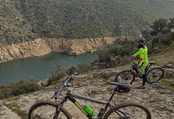
This project has been linked to CiclaMadrid. A much larger cycling project, 420 km long, covering our entire community and crossing the Sierra de Guadarrama destination through its central axis from southwest to northeast. This section of CiclaMadrid has been the backbone of our proposal, which consists of a total of 8 bidirectional cycling loops with over 300 km of cyclable terrain.
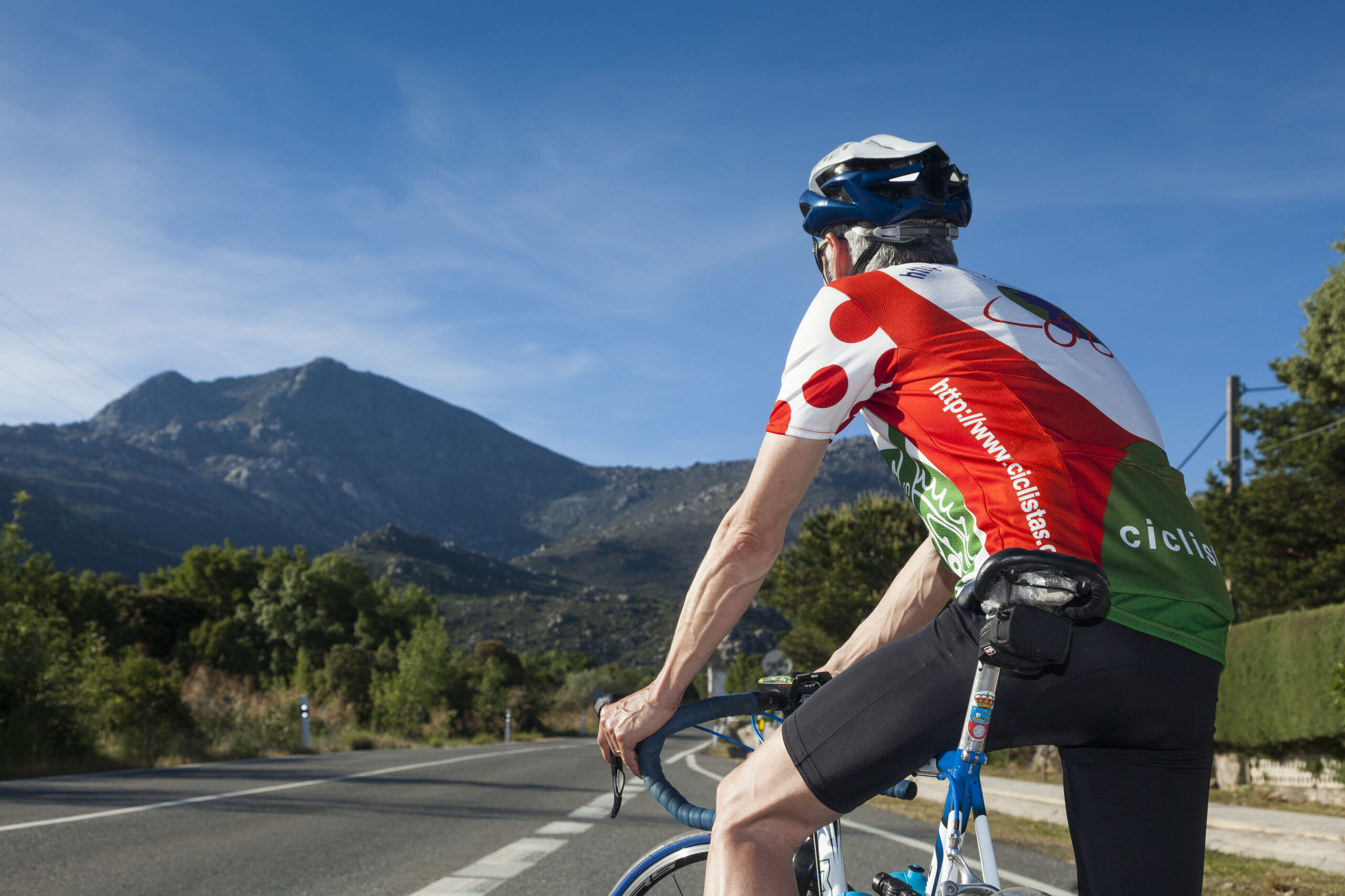
Photo: Silvia’s Studio
You might be interested in
The 14 Must-Sees of the Sierra de Guadarrama
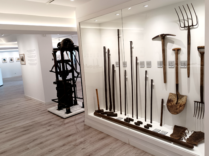
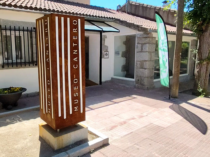
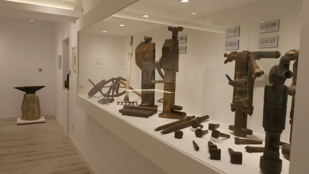
Alpedrete Stonemason Museum
Stonemasonry is one of the most recognized trades in the town of Alpedrete.
View map
Any route, regardless of its nature, that runs through the Sierra de Guadarrama must make a stop in this municipality between Guadarrama and Collado Villalba to admire the history narrated in stone and preserved since the 13th century.
The Alpedrete Stonemason Museum is today a place that bears witness to a traditional craft, which has extracted stone to shape some of Madrid’s most recognizable buildings, such as the Bank of Spain, the Royal Palace, or the Monastery of San Lorenzo de El Escorial.
You might be interested in
The 14 Must-Sees of the Sierra de Guadarrama
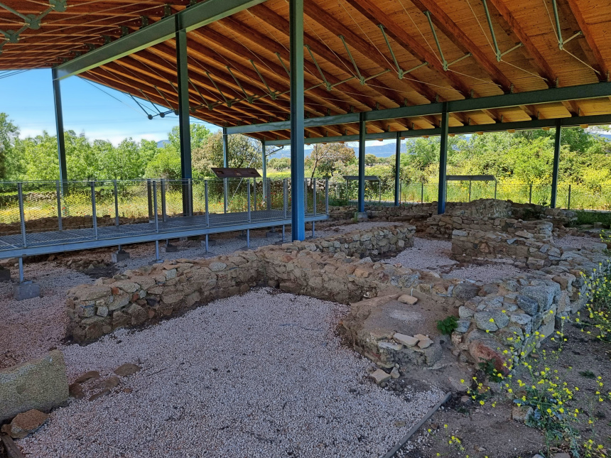
Roman Inn El Beneficio
View map
Among the 14 must-sees of the Sierra de Guadarrama, which you can visit at this link, is one of the most important Roman sites in the Community of Madrid. You can reach it, among other ways, via the Bucle Oeste (West Loop), which runs through the towns of Alpedrete, Becerril de la Sierra, El Boalo-Cerceda-Mataelpino, Moralzarzal, and Collado Mediano, the municipality to which this site belongs. It features an interpretation center and guided tours. There, you can trace commercial life, the lodgings where travelers stayed overnight, and thermal baths with their different rooms with various water temperatures.
You might be interested in
The 14 Must-Sees of the Sierra de Guadarrama
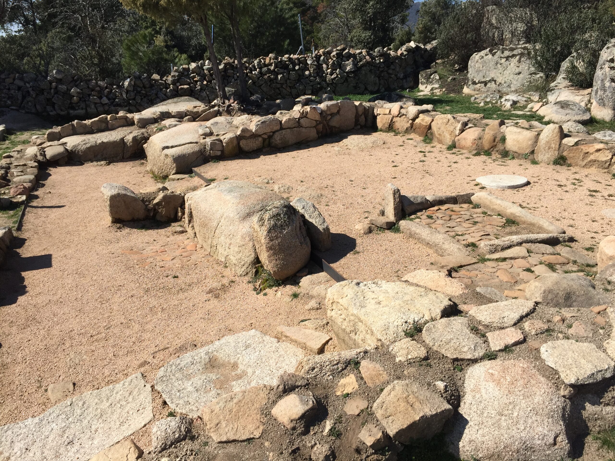
La Cabilda Archaeological Site
View map
The different cycling routes that cross the Sierra de Guadarrama have various stops that allow you to get to know the territory up close.
Some of them stop in the town of Hoyo de Manzanares, which, on the outskirts of its urban center, invites travelers to contemplate the La Cabilda Archaeological Site, a Visigothic village from the 7th century AD. The site is signposted for self-guided tours and is one of the most interesting archaeological sites in our community, allowing us to witness an archaeology initiative that is completely open to the public.
new
Kilometer 0 Gastronomy
Cycling through the paths and trails of the MadRural territories is a different way to connect with nature and the history of the Community of Madrid. After cycling through mountains, valleys, and charming towns, there’s nothing better than stopping to savor the kilometer 0 gastronomy that distinguishes the Sierra Norte de Madrid, the Sierra de Guadarrama, the Sierra Oeste, and the Vegas & Alcarria Madrileña. In each territory, the table offers a reflection of its identity: oils made with native varieties, wines with Protected Designation of Origin, artisanal cheeses, honeys with unique nuances, or legumes cultivated in local gardens. A complete experience where the effort of the journey is rewarded with the most authentic flavors of MadRural.
Access all gastronomic routes at this link.
Vegas & Alcarria Madrileña
To enjoy the kilometer 0 gastronomy of the Vegas & Alcarria Madrileña, we recommend you explore each and every one of the routes through the different culinary experiences of the territory. We propose a journey through wine tourism, with stops in Chinchón, Belmonte de Tajo, Colmenar de Oreja, Nuevo Baztán, Morata de Tajuña, Titulcia, Valdelaguna, Villaconejos, and Villarejo de Salvanés.
But, in addition to its famous wines, the Vegas & Alcarria Madrileña is well recognized for the quality of its olive oils, produced using traditional techniques that tell the story of its fields and its people. You will enjoy guided tours through immense olive groves and oil mills where you can taste each and every variety.


In towns like Ciempozuelos, Chinchón, Fuentidueña de Tajo, and Titulcia, you can taste cheeses like Marqués de Mendiola, savor anise produced with natural ingredients, enjoy everything offered by Te traigo la huerta and Más que tierra, seasonal fruits and vegetables, legumes, nuts, and products cultivated with care, effort, and affection. We also invite you to enjoy the olives and cheeses from Campo Real, the beans and garlic soup from Chinchón, or the sweets made by the nuns of the Convent of the Clarisas. Not to mention the pozas, patatas chulas, or the veal cooked in the traditional style of Colmenar de Oreja, where you can also enjoy desserts like pelotas de fraile or limoncillo. And how about a vermouth to start an unforgettable gastronomic journey?

Jams and Carmelite delicacies from Loeches, honey from Estremera, palmeritas from Morata de Tajuña, typical products from Nuevo Baztán at its LaRED Mercado, tomatoes with an intense flavor from Orusco de Tajuña, tripe a la madrileña from Perales de Tajuña, rabbit stews from the fields of Titulcia, the cocido from Valdilecha, or the tortilla en caldo, sweetbreads, and beans with hare and partridge from Villarejo de Salvanés.
Even with all this, do you need more reasons to try the kilometer 0 gastronomy of the Vegas & Alcarria Madrileña? Enter this link (PDF gastronomic brochure) and get ready to enjoy.


Sierra Norte de Madrid
The Sierra Norte de Madrid is a region rich in local products that stand out for their quality and authenticity. Among its gastronomic treasures are artisanal cheeses, wild flower honeys, extra virgin olive oils, and designation of origin wines. Each of these products reflects the effort of local producers to preserve traditions and sustainable practices, fostering a circular economy that benefits both residents and visitors. The kilometer 0 gastronomy in the Sierra Norte offers a unique experience, where the proximity between producer and consumer guarantees freshness and flavor. Furthermore, local foods are not only enjoyed in the markets and shops of the area but also form the basis of traditional dishes that invite you to discover the history and territory through your palate.
The Sierra Norte de Madrid is home to a variety of exceptional local products. Among them, artisanal cheeses made with goat and sheep milk stand out, reflecting the flavor of the mountains and the region’s livestock tradition. Wildflower honey is another of the most appreciated products, with a unique flavor that captures the essence of the local flora. Extra virgin olive oil, produced in small olive groves, is notable for its superior quality, while wines with the designation of origin «Vinos de la Sierra de Madrid» offer an excellent representation of local vineyards. These products are not only delicious but also the result of sustainable agricultural practices that support the local economy and promote responsible tourism.
Among the products you can enjoy are honey from May, El Jabardo, or El Bardal, cheeses from La Caperuza and Jaramera, artisanal breads from El Horno de Ángeles and La Panata, smoked products from Madarcos and Pastor, Fanum oil (produced in Torremocha de Jarama using an exclusive centrifugation process and traditional filtration techniques), or Bailandera and Vamos a Beer craft beers. We also cannot forget the sweet taste of San Lázaro natural chocolate, made in Rascafría.

Do you feel like savoring each of the kilometer 0 products you’ll find in the Sierra Norte de Madrid? Enter this link sierranortemadrid.org/productos-locales and come enjoy the Madrid you don’t expect.
Sierra de Guadarrama
The gastronomy of the Sierra de Guadarrama stands out for its high-quality native products, reflecting the region’s natural and cultural richness. Among the most representative ingredients are beef with Protected Geographical Indication, local mushrooms and fungi, as well as aromatic plants and spices that flavor traditional dishes. Furthermore, cheeses made with milk from the native «Cabra del Guadarrama» goat breed and honey of various varieties are essential in the gastronomic offerings. Wines from the «Vinos de Madrid» designation of origin perfectly complement these flavors, while homemade desserts round off a unique culinary experience.

All this gastronomic offer can be enjoyed in an incomparable natural setting, just a few kilometers from Madrid, where visitors not only taste these delicacies but can also immerse themselves in the local culture and heritage. The kilometer 0 gastronomy of the Sierra de Guadarrama ranges from Alimentos Miraflores artisanal cheese, which revives the cheesemaking tradition of the 19th century, and Peña Rubia (Guadalix de la Sierra) to Gabarrera organic craft beer and Gin Monti gin, made with low-mineralization Sierra de Guadarrama water and of the London Dry Gin type. Maltacarballar craft beer and La Abeja Viajera and Tía Pili honeys accompany Ecolactis organic mare’s milk, used to make soaps, cosmetics, food, and food supplements.

Sierra Oeste de Madrid
The Sierra Oeste de Madrid offers a rich, local gastronomy that reflects the essence of its territory. In this region, local products stand out for their quality and tradition, the result of a privileged natural environment and the efforts of its producers. Extra virgin olive oil with the «Aceite de Madrid» Designation of Origin is an emblem of the region, with its low acidity and intense aroma. Alongside it, the robust and fruity wines from the San Martín de Valdeiglesias sub-zone are the perfect accompaniment to any table.
The «Huerta de Villa del Prado» guarantee mark certifies the excellence of the region’s vegetables, which star in traditional dishes such as stews and salads. Meanwhile, rosemary and heather honey offers a sweet taste of nature, while artisanal cheeses, made with native goat milk, are a reflection of centuries of cheesemaking tradition. In local restaurants and markets, these ingredients are transformed into recipes that connect visitors with the history and culture of the Sierra Oeste. From stews and game meats to traditional desserts, every bite celebrates the bond between the land and its people.
Choosing kilometer 0 gastronomy in this region is not only a unique culinary experience but also direct support for small producers and the sustainable development of the region. Discover the authentic flavors of the Sierra Oeste de Madrid, where tradition and sustainability unite to offer an unforgettable gastronomic experience.
