Discovering the Civil War Battles
Colmenar del Arroyo, Fresnedillas de la Oliva, Navalagamella, Santa María de la Alameda, Villar del Olmo, Orusco de Tajuña, Carabaña, Valdaracete, Estremera, Tielmes, Perales de Tajuña, Bustarviejo, Paredes de Buitrago, Gandullas, Buitrago del Lozoya, Guadarrama.
We invite you to tour the scenarios of the Civil War in the Community of Madrid, the Battle of Jarama, the Battle of Brunete, the Madrid Front, the Somosierra Front, and the Guadarrama Front.
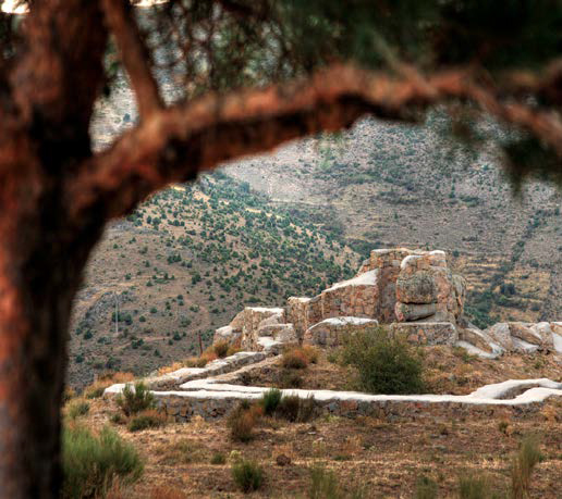
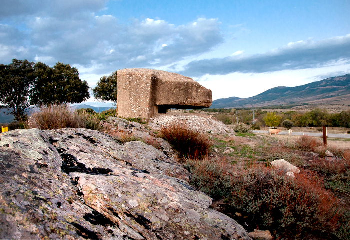
These routes are dotted with blockhouses, bunkers, machine-gun nests, and trenches that are preserved as monuments to the memory of the Spanish Civil War.
Hearing the tranquility that surrounds these blockhouses, it is incredible that a war had been fought here not so long ago. It is worth taking these routes for how interesting their remains are, but also for the beauty and tranquility of their location. Places to think and meditate on the history of men and their senselessness.
RECOMMENDED SEASON
All year round.
TARGET AUDIENCE
History lovers and heritage enthusiasts. Hiking for amateurs.
DURATION
Weekend.
Cultural tourism

Battle of Brunete and Madrid Front
Sierra Oeste
Enjoy a weekend of history and nature by visiting some of the best-preserved vestiges of the Spanish Civil War in the Community of Madrid. Here you will find Blockhaus 13 in Colmenar del Arroyo, the starting point of this route that will take you through the pastures of Fresnedillas de la Oliva and Navalagamella. There you will discover the remains of interesting blockhouses that dot a landscape of holm oaks, overflown by eagles and vultures, as it is located in ZEPA 56 (Special Protection Area for Birds), one of the main bird reserves in the Community.
We recommend staying in Santa María de la Alameda and starting your second day of excursion there, enjoying its silent mountainous landscape while visiting the blockhouses of Las Herreras.
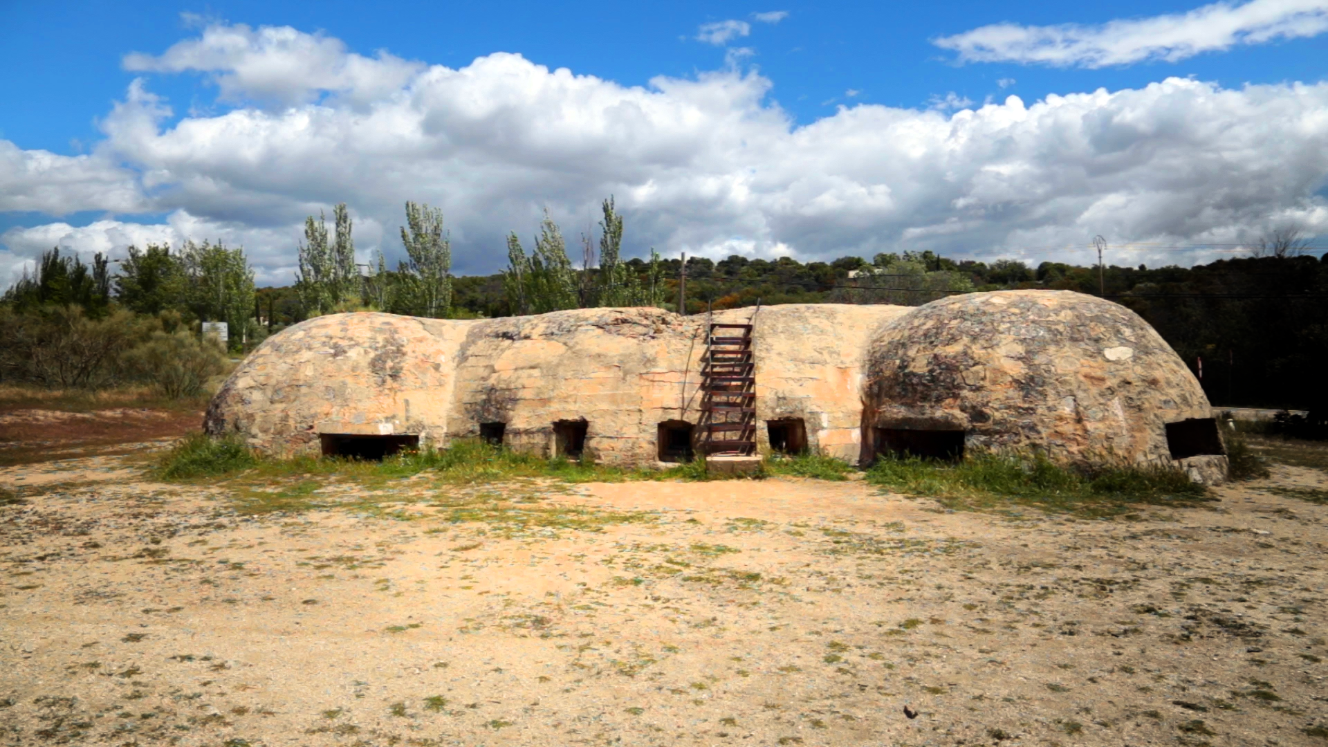
Colmenar del Arroyo
Blockhaus 13.
Declared an Asset of Cultural Interest in 2019.
View on map
Visit: Free
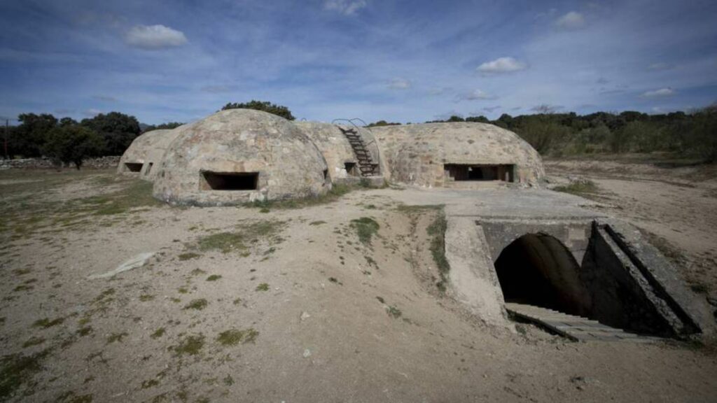
Blockhaus 13 is an imposing reinforced concrete fortification about two kilometers from Colmenar del Arroyo. The blockhouse has about 160 square meters of floor space and consists of a main body with a 10-meter diameter from which four smaller nests are accessed, all with loopholes that allowed it to control the entire surrounding terrain. This building constitutes the highest expression of Civil War military architecture in the Community of Madrid.
Fresnedillas de la Oliva
Blockhouses
View on map
M-521 Road, near the cemetery, and on the M-532, km. 5.8
Visit: Free
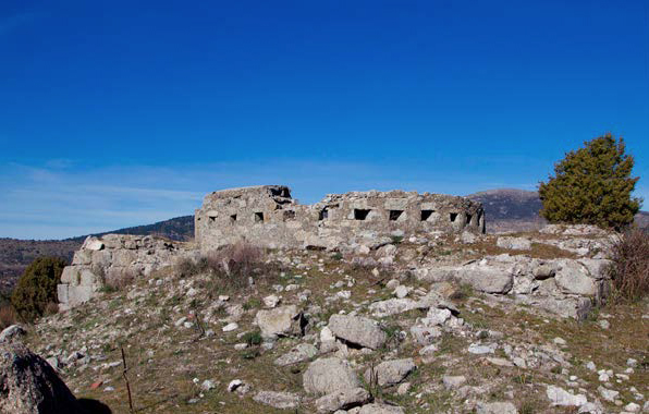
North of the municipality of Fresnedillas de la Oliva, there is a set of very well-preserved blockhouses consisting of shooter parapets with embrasures, trenches, covered machine-gun nests, and communication distributors. These blockhouses are probably one of the best examples of military architecture in the center of the peninsula in their category.
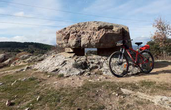
Navalagamella
Calvary Position Blockhouses
Location
Length: 5 km
Difficulty: low. Circular
C/ San Sebastián; M-510 road, Km 5.6
The blockhouse-bunkers are perfectly visible from the road. The best grouping is located on the western slope of a hill, halfway between the Horcajo house and the Alarcón house. They are three fortifications of irregular shape due to the proximity between the machine-gun nests. The cylindrical building served as accommodation for the detachment stationed there. From this point, the ruins of several buildings destroyed during the war can also be observed.
Santa María de la Alameda
Las Herreras Blockhouses
Length: 1.5 km.
Difficulty: Low. Circular
Route start
Blockhouse Location
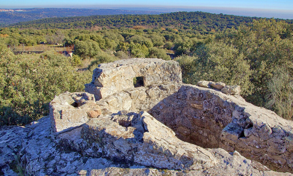
The border of Madrid and Ávila witnessed the first combats of the Civil War. The blockhouses are located on Peña del Águila to the north, on Alto de la Mora to the south, and on Alto de Las Herreras. These blockhouses were part of a National Front military complex and were built between 1936 and 1939, taking advantage of the steep terrain, which provided natural defense. Here we can also find remains of trenches, machine-gun nests, as well as spectacular landscapes.
Interpretation Center for Women in the Civil War
Travesía de la Iglesia, 2
91 898 80 08
turismo@aytonavalagamella.es
www.turismonavalagamella.es
An exhibition space dedicated to the role of women during the Spanish Civil War is located in the rehabilitated building of the old schools. The exhibition traces the role of women during the conflict, which began in 1936, highlighting various associations and relevant female figures from the early 20th and late 19th centuries.

Battle of Jarama
Las Vegas & Alcarria
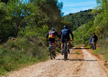
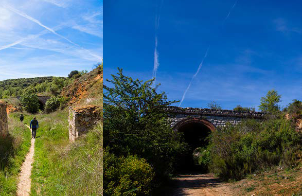
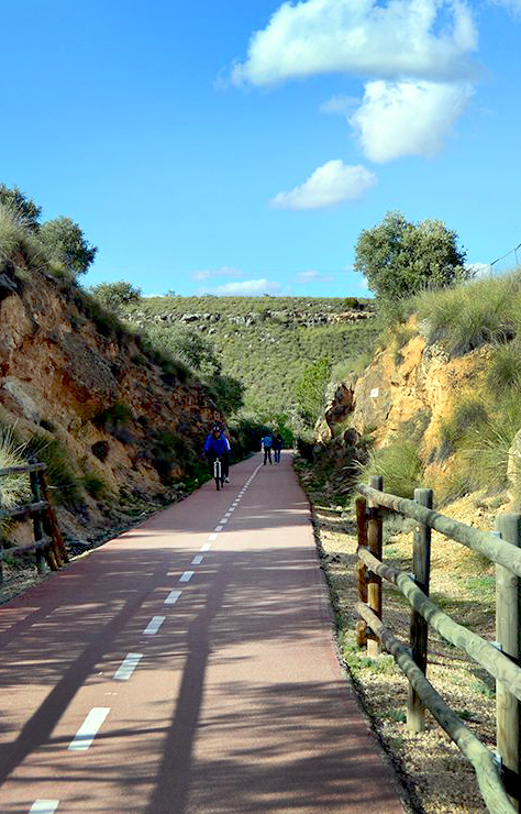
The best way to travel this artery of history and nature is by taking your bike or walking along the 40-Day Railway Route.
Start your route in Villar del Olmo, where you will learn about Civil War testimonies that will take you through Orusco de Tajuña, Carabaña, Valdaracete, and Estremera. Besides the interesting history of this route, the path will take you through a beautiful agricultural landscape of olive trees, vines, and cereals, through rock walls excavated for the railway, sometimes passing under stone bridges.
Extend your route along the Vía Verde del Tajuña; from Carabaña, you can reach Tielmes, Perales de Tajuña, and Morata de Tajuña, where you can continue discovering the vestiges of one of the bloodiest confrontations of the Civil War: the Battle of Jarama. Between the sections from Morata to Perales, you can see the unique Risco de las Cuevas.
Also, you are in a land of wines. Are you going to leave without trying them?
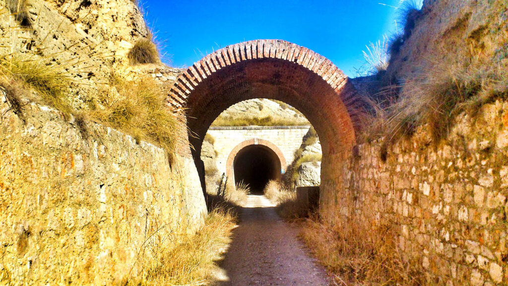
Greenway of the 40-Day Train or Negrín Route
During the Spanish Civil War, Madrid was almost besieged, except for the gap between the current Barcelona and Valencia roads. During the years 1937 and 1938, this railway line was created in «40 days» to connect the two lines: Madrid-Zaragoza and Madrid-Levante, so that the capital would not be isolated and lack supplies.
Its purpose was to supply food and weapons to Madrid. Once the war was over, this railway had no purpose, and in the early 1940s, it was dismantled.

Villar del Olmo Section
Length: 12 km
Difficulty: low. Circular
Route start
The path runs along the valley slope, passes through several tunnels, and has viewpoints and the possibility of connecting with other paths such as the Cañada de las Merinas and the route to the Escurrizo fountain, a stopping and resting point to quench the thirst of shepherds and animals that traveled the livestock trail.
Villar del Olmo, Orusco de Tajuña, Carabaña, Valdaracete, Estremera
Length from Carabaña to Estremera: 15 km
Difficulty: medium-low. Linear
View location
This route is very easy and pleasant to do, as the entire path is asphalted and also free of road traffic (although caution is needed at road crossings). It is exciting to pass through its tunnels and also through its trenches: paths cut «with a knife» that cross the hills, and which now form cuttings where you can walk, both on foot and by bicycle. In Carabaña, the route coincides for a section with the 40-Day Railway Route.

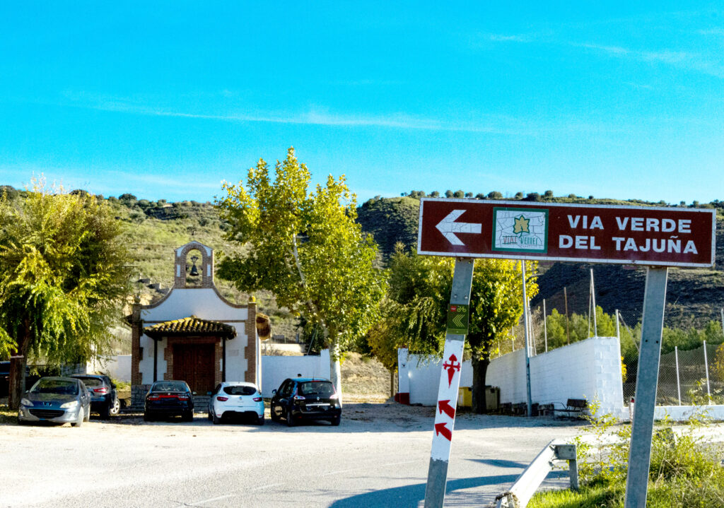
Vía Verde del Tajuña. From Carabaña to Tielmes and Perales de Tajuña
Length from Carabaña to Tielmes: 7 km.
Length from Tielmes to Perales de Tajuña: 6 km.
Difficulty: low. Linear
The route runs through an agricultural landscape with gentle profiles, without ramps. Near Carabaña, there is the Chávarri station, once the warehouse for the famous «Aguas de Carabaña», and in Tielmes, the most representative Neolithic dwellings in the area. Our red track leads us smoothly to El Risco de las Cuevas, a complex of 47 artificial caves located on the right bank of the Tajuña River, which have been declared Assets of Cultural Interest.
A recommendation:
We recommend you go from Perales via the Vía Verde to Morata de Tajuña to visit the museum and the park of the Battle of Jarama. And come to the Battle of Jarama days in Morata de Tajuña, on the second weekend of March, where Morata becomes a living museum thanks to historical reenactments, guided tours, conferences, and screenings.
Museum of the Battle of Jarama
C/ Carmen, 36 (Restaurant ‘El Cid’)
91 873 01 81
From Perales de Tajuña to Morata via the Vía Verde del Tajuña
Length: 3.16 km
Difficulty: low. Linear
Google Maps coordinates, route start:
Route start
On this section of the Vía Verde del Tajuña, on the way to Perales, we can see two vestiges of what was called the «2nd Defense Line of the Jarama», built by the Republican army: a machine-gun nest in excellent state of conservation and an immense cave where troops took shelter.

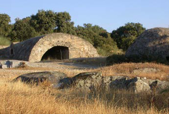
The Somosierra Front and the Water Front
Sierra Norte
From the beginning of the War, the defense of the Puentes Viejas and El Villar reservoirs, vital for supplying water to Madrid, kept this front in permanent tension.
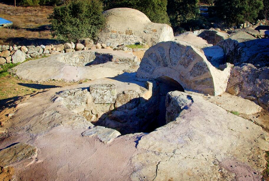
Start your day by taking the Somosierra Front route. A 2.5-hour visit of great historical interest that covers the front line of both sides, allowing you to observe a wide variety and quantity of military construction remains such as machine-gun nests, an observatory, trenches… In addition to other sites such as troop kitchens or the supply center.
Spend the night in Piñuecar-Gandullas, and the next day head to Paredes de Buitrago to visit the Water Front. Start by visiting the Interpretation Center of the Water Front. This route of approximately 3 hours has the largest concentration of preserved war infrastructure from both sides.
Piñuecar-Gandullas
Somosierra Front
Length: 7.4 km
Difficulty: 2 / 5. Circular
Route start
A route of medium difficulty if we climb Cerro de Piñuecar. Another of the jewels, in terms of historical routes, in the Sierra Norte. It covers one of the most important fronts of the Spanish Civil War and one that remained active for the longest time. This circumstance has left us with a multitude of war infrastructure from both sides.

Paredes de Buitrago
Civil War Route. Water Front
Length: 10.6 km
Difficulty: 2 / 5. Circular
Route start
Loma Quemada Position
Water Front Location
A very complete historical itinerary on one of the most important events of the 20th century: the Spanish Civil War. It allows you to learn about the different war infrastructures of both sides due to the proximity of both fronts.
Interpretation Center of the Water Front
At the start of the Route (Paredes de Buitrago), there is an interpretation center for the Water Front route; visiting it will help us put this historically and patrimonially valuable route into context.

A recommendation:
Take the guided tours: “Between trenches and water: the passage of the Civil War in the Sierra Norte” and “Paredes de Buitrago, a fortified town”.
Dare to take the cycling route that starts in Buitrago del Lozoya:
“On the front line. Civil War in the Sierra Norte”
Length: 41 km
Difficulty: 4 / 5. Circular
Route start
Through the common thread of the Civil War in the Sierra Norte and the valuable war infrastructures that are preserved, we propose a cycling route to enjoy the tranquility of the mountain paths and roads while touring the water front and the Somosierra front.
The Guadarrama Front
Sierra de Guadarrama
Nature and history go hand in hand in a landscape of great beauty, such as the Sierra de Guadarrama, a transit area between the two plateaus over the centuries through various passes and cols, which therefore became a transcendental space for both sides during the Civil War.
The conflict thus left numerous vestiges of war constructions in the territory of the municipality of Guadarrama, generally in strategic locations accompanied by environments of great natural and visual beauty.
These remains, essential to our history, have been preserved defiantly despite all the new uses of the Sierra. They are interesting both for their historical significance and the many legends surrounding them, as well as for the richness of the natural heritage that houses them. Respect for the past leads to the desire to preserve and better understand these places that invite long and interpreted visits.
More information at:
https://sierraguadarrama.info/tras-las-huellas-de-la-guerra/
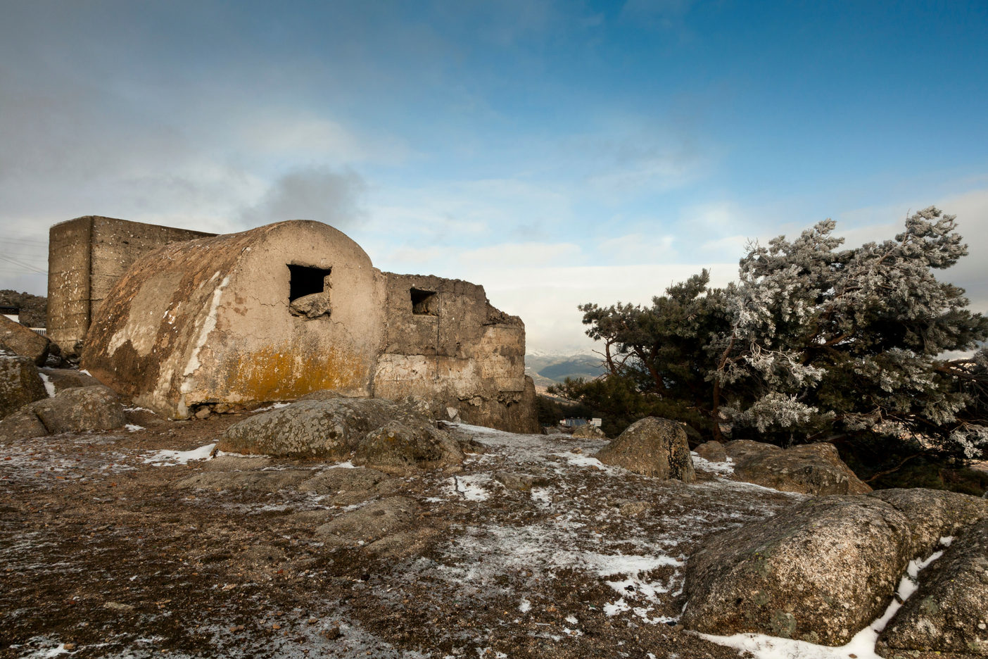
Photo: El Estudio de Silvia
new
Kilometer 0 Gastronomy
This proposal to discover the vestiges of the Civil War in the Community of Madrid and the MadRural territories can be enriched with a visit to the towns closest to the places where all the decisive events that marked the course of our country took place. In these towns, it is worth taking routes through their wineries, oil mills, or restaurants to taste typical gastronomy that defines the flavor of each of the territories that make up MadRural: Sierra Norte de Madrid, Las Vegas & Alcarria Madrileña, Sierra Oeste de Madrid, and Sierra de Guadarrama. Meats, wines, oils, honeys, craft beers, chickpeas, and the Huerta de Madrid… Do you want to discover the best flavors of the Community of Madrid? Let yourself be guided by MadRural!
Vegas & Alcarria Madrileña
To enjoy the kilometer 0 gastronomy of the Vegas & Alcarria Madrileña, we recommend exploring all the routes through the different culinary experiences of the territory. We propose a journey through wine tourism, with stops in Chinchón, Belmonte de Tajo, Colmenar de Oreja, Nuevo Baztán, Morata de Tajuña, Titulcia, Valdelaguna, Villaconejos, and Villarejo de Salvanés.
But, in addition to its famous wines, the Vegas & Alcarria Madrileña is well recognized for the quality of its olive oils, produced using traditional techniques that tell the story of its fields and its people. You will enjoy guided tours through immense olive groves and oil mills where you can savor each and every variety.


In towns like Ciempozuelos, Chinchón, Fuentidueña de Tajo, and Titulcia, you can taste cheeses such as Marqués de Mendiola, savor anise produced with natural ingredients, enjoy everything offered by Te traigo la huerta and Más que tierra, seasonal fruits and vegetables, legumes, nuts, and products cultivated with care, effort, and affection. We also invite you to enjoy the olives and cheeses from Campo Real, the beans and garlic soup from Chinchón, or the sweets made by the nuns of the Clarisas convent. Without forgetting the pozas, chulas potatoes, or the desarreglo veal from Colmenar de Oreja, where you can also enjoy desserts like pelotas de fraile or limoncillo. And how about a vermouth to start an unforgettable gastronomic day?

Jams and Carmelite delicacies from Loeches, honey from Estremera, palmeritas from Morata de Tajuña, typical products from Nuevo Baztán at its LaRED Mercado, tomatoes with an intense flavor from Orusco de Tajuña, Madrid-style tripe from Perales de Tajuña, rabbit stews from the fields of Titulcia, cocido from Valdilecha, or the tortilla in broth, gizzards, and beans with hare and partridge from Villarejo de Salvanés.
Even with all this, do you need more reasons to try the kilometer 0 gastronomy of the Vegas & Alcarria Madrileña? Enter this link (PDF gastronomic brochure) and get ready to enjoy.


Sierra Norte de Madrid
The Sierra Norte de Madrid is a region rich in local products that stand out for their quality and authenticity. Among its gastronomic treasures are artisanal cheeses, wildflower honeys, extra virgin olive oils, and designation of origin wines. Each of these products reflects the effort of local producers to preserve traditions and sustainable practices, fostering a circular economy that benefits both residents and visitors. The kilometer 0 gastronomy in the Sierra Norte offers a unique experience, where the proximity between producer and consumer guarantees freshness and flavor. Furthermore, local foods are not only enjoyed in the area’s markets and shops but also form the basis of traditional dishes that invite you to discover the history and territory through your palate.
The Sierra Norte de Madrid is home to a variety of exceptional local products. Among them, artisanal cheeses made from goat and sheep milk stand out, reflecting the flavor of the mountains and the region’s livestock tradition. Wildflower honey is another of the most appreciated products, with a unique flavor that captures the essence of the local flora. Extra virgin olive oil, produced in small olive groves, is notable for its superior quality, while wines with the designation of origin from the Sierra de Madrid offer an excellent representation of local vineyards. These products are not only delicious but also the result of sustainable agricultural practices that support the local economy and promote responsible tourism.
Among the products you can enjoy are honey from May, El Jabardo, or El Bardal; cheeses from La Caperuza and Jaramera; artisan breads from El Horno de Ángeles and La Panata; smoked products from Madarcos and Pastor; Fanum oil (produced in Torremocha de Jarama following an exclusive centrifugation process and traditional filtration techniques); or Bailandera and Vamos a Beer artisan beers. We also cannot forget the taste of natural chocolate sweets from San Lázaro, made in Rascafría.

Do you fancy savoring each of the kilometer 0 products you will find in the Sierra Norte de Madrid? Enter this link sierranortemadrid.org/productos-locales and come enjoy the Madrid you don’t expect.
Sierra de Guadarrama
The gastronomy of the Sierra de Guadarrama is characterized by its high-quality native products, reflecting the region’s natural and cultural richness. Among the most representative ingredients are beef with Protected Geographical Indication, local mushrooms and fungi, as well as aromatic plants and spices that flavor traditional dishes. Furthermore, cheeses made with milk from the native «Cabra del Guadarrama» goat breed and honey of various varieties are essential to the gastronomic offerings. Wines from the «Vinos de Madrid» designation of origin perfectly complement these flavors, while homemade desserts round off a unique culinary experience.

All this gastronomic offer can be enjoyed in an incomparable natural setting, just a few kilometers from Madrid, where visitors not only taste these delicacies but can also immerse themselves in the local culture and heritage. The kilometer 0 gastronomy of the Sierra de Guadarrama ranges from Alimentos Miraflores artisan cheese, which revives the cheese-making tradition of the 19th century, and Peña Rubia (Guadalix de la Sierra) to Gabarrera organic artisan beer and Gin Monti gin, made with low-mineralization Sierra de Guadarrama water and of the London Dry Gin type. Maltacarballar artisan beer and La Abeja Viajera and Tía Pili honeys accompany Ecolactis organic mare’s milk, used to make soaps, cosmetics, food, and food supplements.

Sierra Oeste de Madrid
The Sierra Oeste de Madrid offers a rich proximity gastronomy that reflects the essence of its territory. In this region, local products stand out for their quality and tradition, the result of a privileged natural environment and the efforts of its producers. Extra virgin olive oil with the «Aceite de Madrid» Designation of Origin is an emblem of the region, with its low acidity and intense aroma. Alongside it, the wines from the San Martín de Valdeiglesias sub-zone, robust and fruity, are the perfect accompaniment to any table.
The «Huerta de Villa del Prado» guarantee mark certifies the excellence of the region’s vegetables, which star in traditional dishes such as stews and salads. For its part, rosemary and heather honey offers a sweet taste of nature, while artisanal cheeses, made with native goat milk, are a reflection of centuries of cheese-making tradition. In local restaurants and markets, these ingredients are transformed into recipes that connect visitors with the history and culture of the Sierra Oeste. From stews and game meats to traditional desserts, every bite celebrates the bond between the land and its people.
Choosing kilometer 0 gastronomy in this region is not only a unique culinary experience but also direct support for small producers and the sustainable development of the region. Discover the authentic flavors of the Sierra Oeste de Madrid, where tradition and sustainability unite to offer an unforgettable gastronomic experience.
